Science
New Brunswick Researchers Harness AI and Satellites to Protect Old Forests
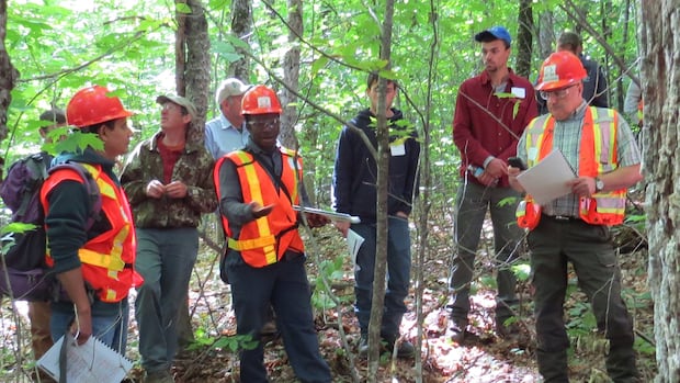
A research initiative based in New Brunswick is leveraging satellite imaging and artificial intelligence to identify and monitor old forests. This project, led by the Northern Hardwoods Research Institute, aims to enhance management practices within the forestry sector. Supported by a grant of $250,000 from the Canadian Space Agency, the team operates from its facility in Edmundston and is dedicated to safeguarding critical habitats that support diverse ecosystems.
By utilizing satellites that capture images of the same forested areas on a weekly basis, researchers intend to develop a comprehensive understanding of old forest locations. According to Gaetan Pelletier, executive director of the institute, the initiative will equip forestry managers with the necessary tools to protect these vital environments. He stated, “They are special ecosystems, and today we’re not equipped with the technology or tools to find out where they are before we enter an area and conduct harvesting.”
Identifying and Monitoring Key Habitats
Old forests serve as critical habitats for numerous species, yet foresters often lack the means to recognize these areas until harvesting is underway. Pelletier highlighted the importance of this project, explaining that it will not only locate old forest types but also track changes over time. The satellites involved are equipped with approximately ten sensors, which will collect data on various forest conditions, including the presence of dead trees and windfalls, as well as hollow trees that serve as habitats.
One notable species that relies heavily on old forests is the chimney swift, a bird known for nesting in urban chimneys and hollow trees in natural environments. Pelletier emphasized the significance of these ecosystems for the chimney swift, stating, “Old forests are a critical habitat for that species.”
The project will employ a dual-layer data collection method using satellite technology. The first layer will identify large forested regions likely to contain hollow trees, while the second layer will pinpoint specific hollow trees. The data collected will eventually inform the operation of harvesting machines, allowing them to navigate around sensitive areas.
Future Implications for Forestry Operations
The vision for this initiative extends beyond identification; it aims to create live maps that will highlight specific areas and trees that should be preserved. Pelletier noted, “We can mark those trees for the navigator and say, ‘Hey, watch out here. Maybe you want to maintain a 30-metre buffer because we think there is a hollow tree being used by chimney swifts and brown bats and other species.’”
The project is set to unfold over an estimated 18 to 24 months, with the team planning to provide preliminary solutions for testing by March 2026. Ultimately, the goal is to have prototype map data ready for use by forestry professionals across New Brunswick by the following fall. This initiative is one of twenty projects nationwide that received funding from the Canadian Space Agency, collectively aimed at integrating advanced technologies into environmental conservation efforts.
The Northern Hardwoods Research Institute anticipates that the total cost of the project will reach approximately $500,000, underscoring the commitment to fostering sustainable forestry practices that protect essential ecosystems for generations to come.


Asian Markets Mixed as U.S. Stocks Approach All-Time Highs

Googoosh Launches Farewell Tour Amid Iran’s Societal Change

Steelpan Revival: A New Generation Embraces Trinidad’s Heritage

Denison Mines Signs Key Agreement with Métis Nation–Saskatchewan

Xu and Chen Donate $10 Million to Enhance USask Arts Education

Holiday Concerts Bring Festive Cheer to Victoria Island

New Study Reveals Remote Work’s Positive Impact on Mental Health

Navigating Holiday Meals: Safety Tips for Food Allergies

St. Bede’s Heiberger Sinks Last-Minute 3-Pointer for Victory

Secwepemc First Nation Seeks Aboriginal Title Over Kamloops Area

Scientists Unearth Ancient Antarctic Ice to Unlock Climate Secrets

Trump and McCormick to Announce $70 Billion Energy Investments

Four Astronauts Return to Earth After International Space Station Mission
TransLink Launches Food Truck Program to Boost Revenue in Vancouver

Apple Notes Enhances Functionality with Markdown Support in macOS 26

Manitoba’s Burger Champion Shines Again Amid Dining Innovations

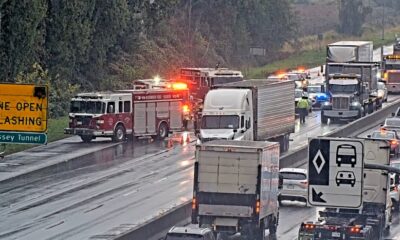
Urgent Update: Fatal Crash on Highway 99 Claims Life of Pitt Meadows Man

Ukrainian Tennis Star Elina Svitolina Faces Death Threats Online
-
 Politics4 weeks ago
Secwepemc First Nation Seeks Aboriginal Title Over Kamloops Area
-
 World5 months ago
Scientists Unearth Ancient Antarctic Ice to Unlock Climate Secrets
-
 Entertainment5 months ago
Trump and McCormick to Announce $70 Billion Energy Investments
-
 Science5 months ago
Four Astronauts Return to Earth After International Space Station Mission
-

 Lifestyle5 months ago
TransLink Launches Food Truck Program to Boost Revenue in Vancouver
-
 Technology3 months ago
Apple Notes Enhances Functionality with Markdown Support in macOS 26
-
 Lifestyle3 months ago
Manitoba’s Burger Champion Shines Again Amid Dining Innovations
-
 Top Stories2 months ago
Urgent Update: Fatal Crash on Highway 99 Claims Life of Pitt Meadows Man
-
 Politics4 months ago
Ukrainian Tennis Star Elina Svitolina Faces Death Threats Online
-
 Sports5 months ago
Search Underway for Missing Hunter Amid Hokkaido Bear Emergency
-

 Politics5 months ago
Carney Engages First Nations Leaders at Development Law Summit
-

 Technology5 months ago
Frosthaven Launches Early Access on July 31, 2025