Top Stories
University of Calgary Professor Wins Award for 3D Mapping Innovation
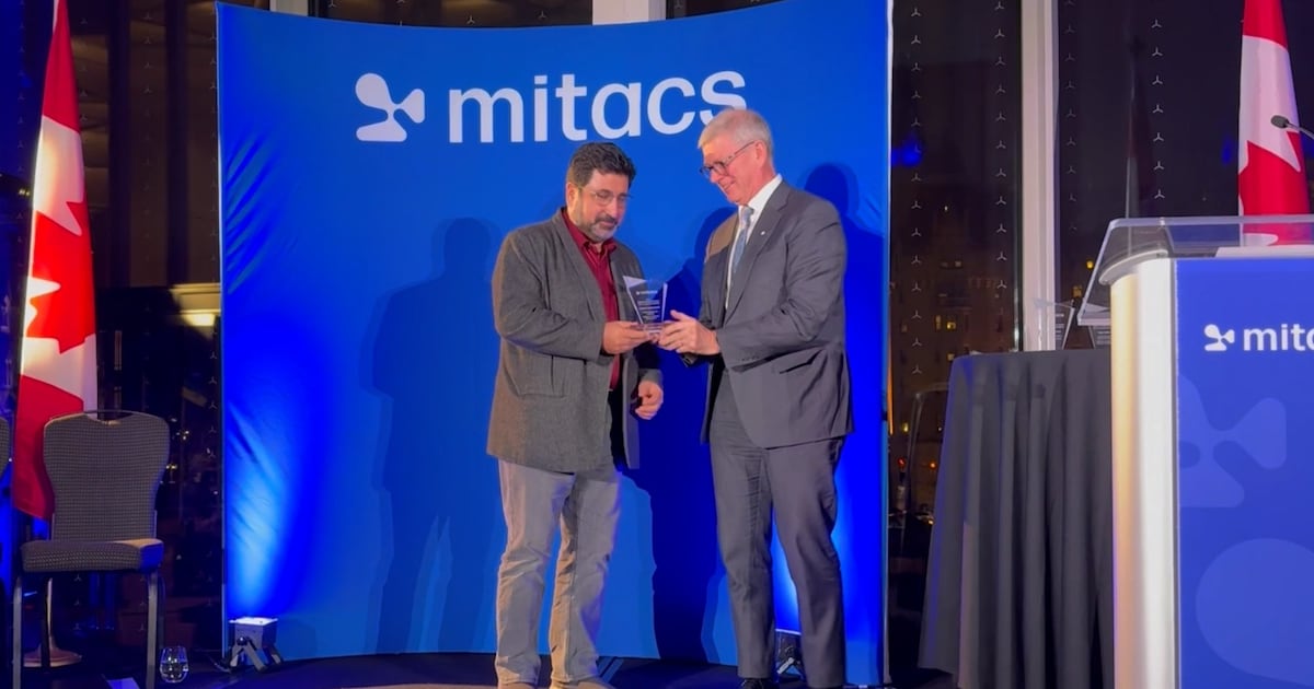
UPDATE: A University of Calgary professor has just been awarded the prestigious Mitacs Innovation Award for Outstanding Research Leadership for his groundbreaking work in 3D digital mapping. Faramarz Samavati, a leader in computer science, has dedicated 15 years to developing a system that promises to revolutionize how we understand geographic data.
This recognition from Mitacs highlights the urgent need for improved accuracy in digital mapping, as conventional applications often present distorted views of our planet. Samavati’s innovation seeks to correct these inaccuracies, particularly in how continents are represented, making them more reflective of their true sizes. He explained, “Digital maps like Google Maps show Greenland as much larger than Brazil, but in reality, it is smaller. Our 3D model eliminates these distortions.”
The project, developed in collaboration with Calgary-based Vivid Theory, introduces a Discrete Global Grid System (DGGS), which divides the Earth’s surface into small, manageable cells. This system assigns unique codes to these cells, akin to postal codes, enabling more efficient data storage and processing. “By establishing a framework that accounts for the Earth’s curvature, we can significantly enhance our ability to manage vast amounts of geographic data,” Samavati stated.
Graduate student Lakin Wecker emphasized the speed aspect crucial to the project. “We’re measuring processing speed in nanoseconds, aiming to reduce time from 20 nanoseconds to 10 nanoseconds per data point. This might seem trivial, but when dealing with billions of records, that efficiency becomes vital,” he said.
Samavati’s partnership with BigGeo, a startup focused on location-based data, is also noteworthy. CEO Brent Lane remarked, “BigGeo is at the forefront of the $1 trillion spatial economy. Our collaboration with Samavati will leverage AI to provide users with faster, more accurate geographic information.” Lane highlighted the critical role of spatial data, which constitutes 80 percent of all data globally.
The implications of this work extend beyond mere mapping; Samavati envisions a “living digital twin” of Earth that could transform our understanding of environmental phenomena and assist in disaster prediction. “This innovation will help us comprehend our planet better, facilitating tools to predict disasters that affect lives,” he asserted.
Mitacs awards are designed to honor supervisors who excel in fostering industry partnerships and providing enriching research experiences. The award is part of a program bolstered by funding from the Government of Canada and provincial authorities.
As this innovative project continues to develop, it promises not only to enhance digital mapping but also to reshape how we interact with geographic data in everyday life. Stay tuned for more updates on this transformative technology.
For additional information about BigGeo, visit their website.


Morris Churches Unite for Annual Good Friday Walk With the Cross

Chloe Zhao’s ‘Buffy’ Reboot Cancelled: Sarah Michelle Gellar Speaks Out

Essential Ingredients for Life Found in Ryugu Asteroid Samples

Urgent Rescue: NSR Airlifts Injured Climber from Nanaimo

Riverside Heart Ball Achieves Record $815,000 for Mental Health

Cognizant Launches AI Factory to Enhance Enterprise AI Scalability

Samsung’s Galaxy Watch 9 to Feature Larger Battery Than Before

Toronto’s AIDS Memorial Faces Potential Redesign Amid Community Concerns

Bayern Munich Loses Luis Díaz Red Card Appeal Despite Referee’s Admission

Secwepemc First Nation Seeks Aboriginal Title Over Kamloops Area

Fatal Crash on Highway 11 Claims Three Lives, Major Closure Ongoing

Manitoba’s Burger Champion Shines Again Amid Dining Innovations

Canadian Curler E.J. Harnden Announces Retirement from Competition

Urgent Fire Erupts at Salvation Army on Christmas Evening

Scientists Unearth Ancient Antarctic Ice to Unlock Climate Secrets

Trump and McCormick to Announce $70 Billion Energy Investments

Minister Faces Scrutiny Over Delayed Foreign Interference Watchdog Appointment

Monika Hibbs Unveils Acres Market & Interiors in Major Rebrand
-
 Politics5 months ago
Secwepemc First Nation Seeks Aboriginal Title Over Kamloops Area
-
 Top Stories4 months ago
Fatal Crash on Highway 11 Claims Three Lives, Major Closure Ongoing
-
 Lifestyle7 months ago
Manitoba’s Burger Champion Shines Again Amid Dining Innovations
-
 Sports3 months ago
Canadian Curler E.J. Harnden Announces Retirement from Competition
-
 Top Stories3 months ago
Urgent Fire Erupts at Salvation Army on Christmas Evening
-
 World9 months ago
Scientists Unearth Ancient Antarctic Ice to Unlock Climate Secrets
-
 Entertainment9 months ago
Trump and McCormick to Announce $70 Billion Energy Investments
-
 World5 months ago
Minister Faces Scrutiny Over Delayed Foreign Interference Watchdog Appointment
-
 Lifestyle9 months ago
Monika Hibbs Unveils Acres Market & Interiors in Major Rebrand
-
 Science9 months ago
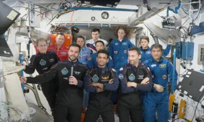
Four Astronauts Return to Earth After International Space Station Mission
-

 Lifestyle9 months ago
TransLink Launches Food Truck Program to Boost Revenue in Vancouver
-

 World1 month ago
Ranchman’s Cookhouse & Dancehall to Relocate by Early 2027